Tuesday, May 3, 2011

Rivers and Glacial Valleys

Alaska is full of glacial terrain, in the area I was in had U shaped glacial valleys that were formed by glacial erosion.


Caption: This is an intermittent braided river in Denali National park. There are also excellent examples of the bedload in between the streams that this river carries when the water level is raised due to mountain runoff.


This meandering river shows the cut backs and deposition along the banks of the river that have been formed by the meandering amplitude. 


While the braided river isn't necessarily a form of transportation for locals since it is intermittent, some of the larger perennial meandering rivers serve as resource transportation from town to town, whether it is via boat or river plane travel.


Image Sources:

First Image- http://en.wikipedia.org/wiki/File:Denali_National_Park.jpg

All others taken by Curtis Stuck.

Thursday, April 7, 2011

Occluded Fronts and Aleutian Lows

Alaska is above the polar front that separates cool and warm air masses of the mid Atlantic region, and it also lies directly along two other lines of air movement, the arctic front and the jet stream.
 
Some of the storms that hit the Northwestern area of the United States during the fall and winter are occluded fronts; which form when a warm air mass is pushed into a cold air mass.  The warm air mass then rises above the cold air mass because it has a lower air density.  As this clash happens the jet stream is pushing the front into the Canadian coast and the western coast of the U.S.
 
Caption: The occluded fronts form near Alaska and are pushed across the Pacific into the coast by the jet stream.  This happens when a low pressure cold front that crosses the Aleutian islands collides with a warm air front from the South Pacific and forms the stormy weather associated with the cyclones that hit the coast.  

When the storm hits the coast the bulk of the cyclone will hit in the Northwestern region of the United States near Oregon and Washington.  The Northwest has a very important role in taking the brunt of the storm, because if anything more than the tail of the storm hits California on a regular basis there could be a bad season for wineries. Probably inadvertently causing the end of the world.

Image Sources In Order of Appearance:
http://berkeleynaturally.files.wordpress.com/2009/12/aleutian-low.jpg

Thursday, March 3, 2011

Angel Rock Hike

The Angel Rock Trail is interlaced with talus that has fallen away from larger rocks all along the hike, as well as several areas of core stones that have built up into tors.  The weathering of theses rocks has created a unique environment that has become known for being a scenic and enjoyable trail to hike.

Caption: This is Angel Rock, the trail is cut in between these rocks all the way to the top of the mountain.

Based on the climate of the area in Alaska many of these rock formations may have been split during the winter due to frost weathering. This would have occurred when the crevices of the rock filled up with water, then froze, thus expanding and separating the joints of the rock.

Caption: You can see the joints in this large rock, as well as other rocks in the foreground of the picture that could be core rocks that have weathered away at a faster rate than the larger forms in the background.


Caption: There is also plant growth in the joints of the rocks (which is only slightly visible here), the roots could also be applying the pressure that has caused the joints to expand and break, in addition to the frost weathering that occurs during the colder times of the year.

The talus of the area has even accumulated into talus cones on a nearby hillside:

As shown by this picture the environment is scenic and has also developed into a home for the animals near Angel Rock, just anthoer reason people have come to enjoy spending their time in this area.

Image Sources in order of appearance:
-Photo taken by Curtis Stuck.
-http://lh3.ggpht.com/_N6yZMKlobEg/TKQCTIKzEOE/AAAAAAAAKNg/JUtED--7y4Yc/AngelRockHike2010.jpg
-Photo taken by Curtis Stuck.

Monday, February 14, 2011

Plates, Mountains, and Faults: Alaskan features around Denali

The area I visited in Alaska was Fairbanks, just outside of Denali National park which is the home of Mount McKinley, or Denali as the native Athabaskans call it.
Mount McKinley was formed by the converging Pacific Plate and North American Plate, the plates are moving by convection to redistribute heat underneath Earth's surface.  The Pacific Plate is being subducted underneath the North American Plate; this process pushes up the continental crust of the North American plate and forms mountains, volcanoes, and oceanic trenches.

While in Alaska I didn't know of the Denali fault, but I was informed by lecture that I missed something substantial.  The fault snapped in 2002 from tension that had complied on it, causing an earthquake rated to a 7.9 on the Richter scale. 

This picture shows a road affected by the fault; this looks like a right lateral strike slip fault even though it isn't the direct site of the Denali fault.

As shown by the previous picture, the faults in this area have the ability to inflict serious damage on the civilization built around them, which is something that the residents have to think about since their homes are along the Ring of Fire.  The local economy surrounding Denali national park also owes most of its livelihood to Mount McKinley since most of the tourism brought in is based upon seeing the massive mountain.

Images (in order of appearance) provided by:
Photo taken by Jon Stuck while in Alaska
http://pubs.usgs.gov/circ/c1187/images/fig05.jpg
http://www.nationalatlas.gov/articles/geology/features/denalifault.html

Some information on plate tectonics was from:
http://www.nps.gov/dena/naturescience/index.htm

Saturday, January 22, 2011

Introductory Blog by Curtis Stuck


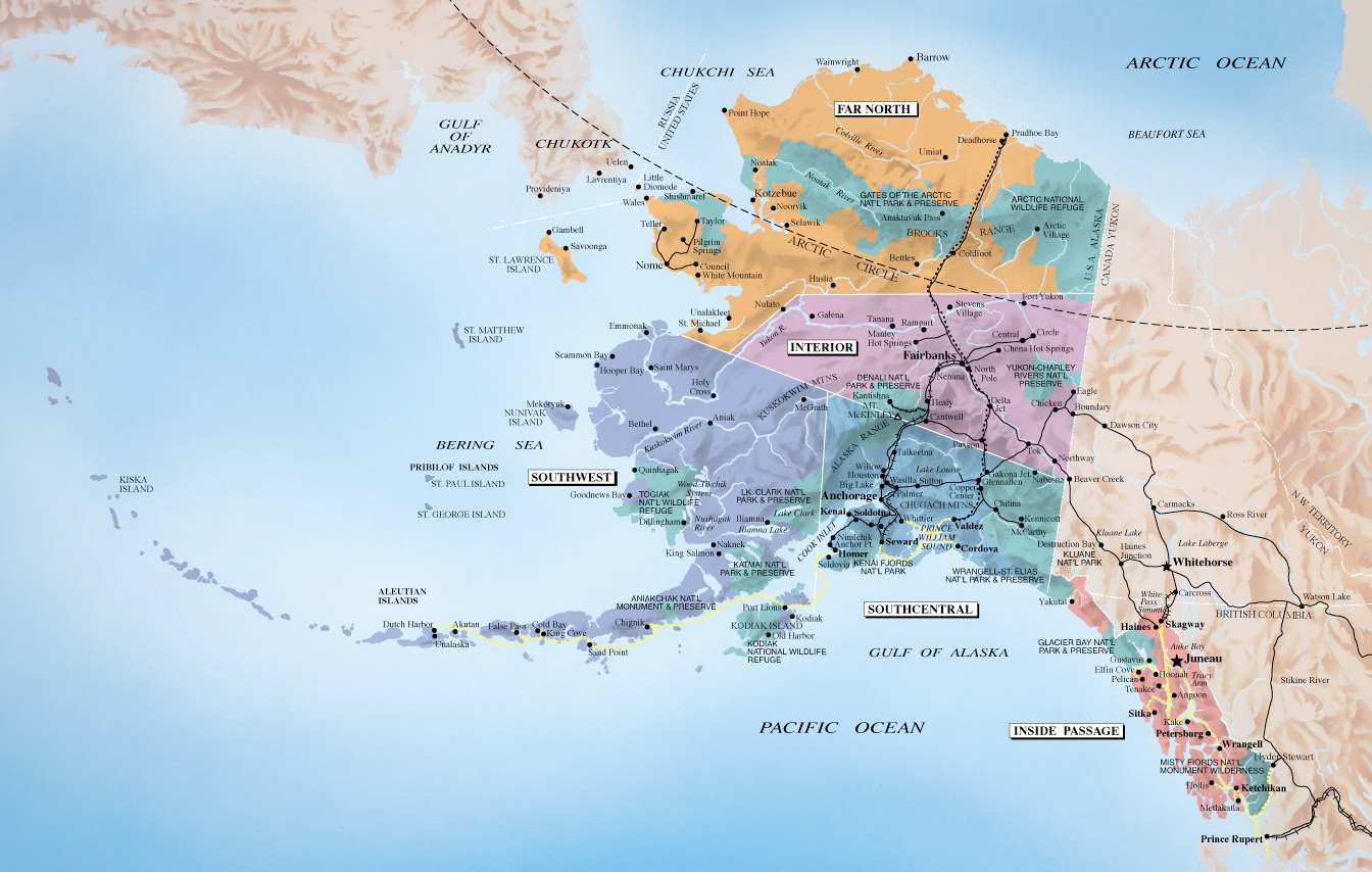
My name is Curtis Stuck, this past August I went on a short trip to Alaska that left me loving the state.  It was an eye opening experience because I typically used to picture the state as nothing more than frozen tundra being drilled for oil.  Obviously I was ignorant to the state's phenomenal environment.  When I found out there was going to be a specific place to study for it's unique and stunning natural architecture the first place that came to mind was Alaska.  I was in Fairbanks, but between my trip through Denali National Park, swimming in the Chena Hot Springs, and hiking Angel Rock I saw a beautiful portion of the state.  With that in mind I can't wait to learn about how the state's natural environment came to be, about how the rock formations that I was climbing around on became what they are today, and about what else I missed when I was there last.

  Image provided by: http://www.studentsoftheworld.info/sites/country/u_s_a.php